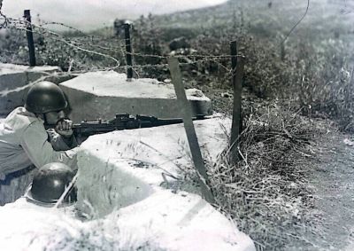
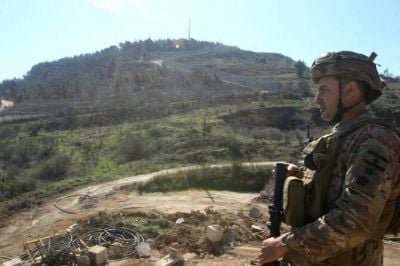
A Lebanese Army soldier stands guard in the village of Odaisseh, in southern Lebanon, across from the Israeli village of Misgav Am, on the border between the two countries. Feb. 18, 2025. (Credit: AFP)
")


")


Rayane Saadeh is a computer and communications engineer.
. (Credit: Reproduced courtesy of the author)")
By insisting on its own cease-fire with Israel — refusing to be folded into the U.S.-Iran cease-fire framework that several countries, most notably France, attempted to link it to — the Lebanese state has stopped sitting on the sidelines of its own destiny. And by initiating direct negotiations with Israel, Beirut has managed to clearly separate Lebanon’s interests from those of Iran and its local stooges, much to Hezbollah’s dismay.
While the outcome of the negotiations remains highly uncertain, President Joseph Aoun and Prime Minister Nawaf Salam’s government could still use these talks to quickly secure an early political and diplomatic victory: a definitive, bilateral confirmation that the Israeli-Lebanese border is the one recognized and demarcated in 1949 by both states, through the Israeli-Lebanese Mixed Armistice Commission.
The border dispute is not just a dusty fixture of Lebanese-Israeli negotiations, whether direct or indirect. It is, first and foremost, a major source of anxiety for the Lebanese.
Across their political and religious differences, most, if not all, are convinced that Israel has long coveted their national territory.
After all, the Zionist Organization did seek a border extending just south of Saida for the envisioned Jewish state at the 1919 Paris Peace Conference, and Israeli leaders such as Moshe Dayan and Levi Eshkol did make troubling statements on the matter after 1967.
Nevertheless, and despite these precedents, Lebanese lands largely remained under the radar of the Israeli settler movement for decades.
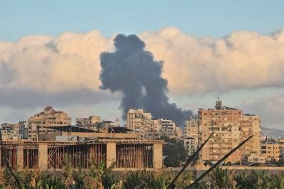
But that changed after Iran launched Hezbollah’s so-called “Gaza Support War” (Harb al-Isnad) on Oct. 8, 2023.
In 2024, a small group of Israeli activists created Uri Tzafon (meaning, “Awake O North!”), the first Israeli movement exclusively dedicated to the colonization of southern Lebanon. The recent resumption of hostilities has since given the group fresh momentum. Extremely marginal at first, it now enjoys growing support from the Israeli far right, including Israeli Finance Minister Bezalel Smotrich.
So, while Israeli Foreign Minister Gideon Saar insists Israel “has no territorial ambitions in Lebanon,” and the Israeli military describes its occupation as merely a temporary “buffer zone,” most Lebanese remain understandably skeptical. And when President Isaac Herzog speaks passionately about Beirut, saying he hopes to one day visit the city as a friend, Beirutis have trouble hearing him over the constant buzz of Israeli drones.
A fundamentally domestic issue
In the April 16 cease-fire agreement, the border issue is mentioned only in the final clause, where Israel and Lebanon commit to holding direct negotiations under U.S. sponsorship to “resolve all remaining issues, including demarcation of the international land boundary, with a view to concluding a comprehensive agreement that ensures lasting security, stability, and peace between the two countries”.
But for many Lebanese, the country’s physical borders are an existential issue, not a pesky technicality.
Outraged by the shrinking of Lebanese territory after the abolition of the Mount Lebanon Emirate in 1843, the Maronite Church led a sustained campaign from at least 1863 onward to secure borders corresponding roughly to those of present-day Lebanon.
Today, Lebanon is probably the only country in the world whose Constitution defines its borders in its very first article.
The current wording dates back to the heights of the struggle against the French Mandate, in November 1943, when Lebanon’s independence leaders (Riad el Solh, Bechara el Khoury, Adel Osseirane etc.) amended its text to describe the country’s boundaries with remarkable precision — even referencing specific bridges and villages as geographic markers, something highly unusual in a constitution.
And while most states, including Israel, have legal mechanisms allowing them to relinquish parts of their territory, Article 2 of the Lebanese Constitution is as brief as it is unequivocal:
“No part of Lebanese territory may be alienated or ceded.”
This deep-seated territorial anxiety might explain why virtually every Lebanese knows the exact size of their country: 10,452 km². And why, far more than a geographic estimate, “10,452 km²” has become a patriotic slogan — one so universally embraced that, despite being launched by Lebanese Forces founder Bashir Gemayel, it was reclaimed without reservations by former Hezbollah leader Hassan Nasrallah, on the opposite end of the political spectrum
Resolving this issue first would therefore significantly strengthen the internal popularity of Lebanon’s embattled executive and help it enforce the other points of the cease-fire.
Luckily, it is also one of the few issues the Washington negotiations could, in theory, settle relatively easily.
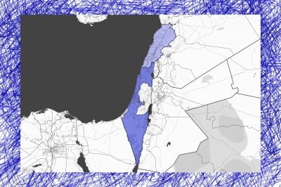
The situation at the border
Contrary to what is often claimed, the Israeli-Lebanese border has already been officially demarcated. Detailed topographic maps at a 1:20,000 scale identify the agreed border markers; where some of those markers no longer exist, they can be restored using the original maps without major difficulty.
The only exception is in the Shebaa Farms area, simply because the Israeli-Lebanese border there is actually the border between Lebanon and the Syrian Golan Heights. By occupying it after 1967, Israel effectively inherited one of the many territorial encroachments Syria had previously made onto Lebanese land.
For the rest of the border, the picture is clear.
It was first established when Lebanon and Syria were under French mandate and Palestine under British mandate. On Feb. 3, 1922, Lieutenant-Colonels Maurice Paulet and Stewart Francis Newcombe — tasked by their respective governments with defining the frontier on the ground — signed an agreement in Beirut establishing what became known as the “Paulet-Newcombe line.”
The boundary was demarcated using topographic maps at a scale of 1:50,000 and marked on the ground by 38 border markers between Lebanon and Palestine.
After Israel’s creation and subsequent victory in the war of 1948, its borders were set by the separate armistice agreements it negotiated under U.N. auspices with each neighboring Arab state.
However, unlike the agreements signed with Egypt, Jordan, and Syria — all of which explicitly stated that the armistice lines could not under any circumstances be interpreted as political borders with Israel — the Ras al-Naqoura armistice agreement with Lebanon declared, without reservations, that “the Armistice Demarcation Line shall follow the international boundary between Lebanon and Palestine.”
This was a deliberate choice by the Lebanese state, which — unlike its Arab allies — had no territorial ambitions in Palestine.
In fact, the Lebanese delegation insisted that the armistice line imply a definitive Israeli recognition of the border, a demand that reportedly delayed the signing of the agreement for several days because of Tel Aviv’s reservations.
Soon after the agreement was signed, however, both states realized that the 1922 Paulet-Newcombe line lacked precision. The 1:50,000 scale maps were too imprecise and the number of border markers too limited.
The Israeli-Lebanese Mixed Armistice Commission began work immediately on a more accurate demarcation. Under U.N. supervision, Captains Ghanem and Friedlander signed an agreement on Dec. 12, 1949, refining the border line.
The resulting Ghanem-Friedlander line was drawn on 1:20,000 scale maps — the standard scale for border demarcation — and established 145 markers along the 78-kilometer frontier, including the 38 inherited from the Paulet-Newcombe line.
Both states equally shared the cost and responsibility of installing the 107 additional markers, as documented in maps produced by the Survey Department of Israel and attached to the minutes of the Mixed Armistice Commission.
. (Credit: Reproduced courtesy of the author)")
By January 1951, according to the United Nations, only a few minor disagreements remained. Lebanese and Israeli officials continued working on them through the Commission, and both sides were reportedly close to closing the file definitively in 1967 — including the signing of eight detailed maps — when the Six-Day War broke out.
Lebanon stayed out of that war, avoiding the major territorial losses suffered by other Arab states.
Nevertheless, that same summer, Israel declared the Israeli-Lebanese armistice agreement null and void, along with the other 1949 armistice accords.
Despite this decision, Lebanese and Israeli military officials continued meeting regularly under U.N. auspices until 1975. Their discussions, however, focused far more on Palestinian armed activity in southern Lebanon than on the border itself.
Israel’s withdrawal in 2000 and the beginning of confusion
At first, the border demarcation survived the litany of wars Lebanon endured after 1975.
In 1983, the Lebanese-Israeli Troop Withdrawal Agreement — more commonly known as the May 17 Agreement — stated in its first article that “the existing international boundary between Lebanon and Israel is inviolable.” The text did not revisit either delimitation or demarcation, thereby treating the issue as already settled.
The agreement, passed by wide majorities in both the Knesset (Israeli parliament) and the Lebanese Parliament, faced fierce opposition from Syria. Lebanon’s president never ratified it, and the deal ended up a dead letter.
To understand today’s confusion surrounding the border, we must go back to the period leading up to Israel’s withdrawal in 2000.
After Israel declared in January 1998, under Benjamin Netanyahu’s first government, that it accepted the principle of withdrawing from southern Lebanon, Prime Minister Ehud Barak pledged on May 27, 1999, to complete a full withdrawal within the following 12 months.
For a time, Barak hoped to use the withdrawal to secure a peace agreement with either Syria or Lebanon. But by November 1999, under pressure from his ministers, he abandoned that objective and began openly discussing unconditional withdrawal.
For Lebanon’s government at the time — itself firmly under Syrian control — the move came as a major shock.
Throughout the 1990s, Beirut had flatly rejected Tel Aviv’s attempts to separate Israel’s withdrawal from southern Lebanon from the broader Syrian-Israeli peace track, as Damascus wanted to use southern Lebanon as leverage in its own negotiations with the Israel (which were, incidentally, direct negotiations).
")
As one of Barak’s ministers had predicted, the unilateral withdrawal immediately embarrassed Israel’s northern neighbors by raising two sensitive questions: the future of the Syrian military presence in Lebanon and the future role of Hezbollah.
In the lead-up to the withdrawal, the Lebanese state did not even dare to imagine its own forces taking back control of the South, since it was hardly in charge of Beirut itself. Instead, then-Defense Minister Ghazi Zeaiter proposed asking the Syrian army to deploy alongside Lebanese forces after the Israeli pullout. Then-President Emile Lahoud went even further, categorically rejecting any deployment of Lebanese security forces in the evacuated South, reviving one of his favorite catchphrases:
“The Lebanese Army will not serve as a watchman for the Occupation” (meaning Israel).
It was ultimately Syria’s foreign minister who settled the matter, announcing on May 26 Beirut’s final position: Hezbollah would remain in place, and the Lebanese state would indeed deploy in southern Lebanon, though limited to just 1,000 personnel split between the army and the gendarmerie. A U.S. diplomatic cable later suggested the number of troops actually deployed was significantly lower.
Remarkably, by forcing this symbolic deployment, Damascus turned out to be more committed than its Lebanese clients to preserving the façade of Lebanese sovereignty.
It was under these conditions that the border issue suddenly resurfaced. To certify that Israel had fully withdrawn, it first had to be established exactly where the border lay.
The U.N.’s chief cartographer, Miklos Pinther, acted as mediator between Lebanon and Israel. He later told U.S. diplomat Frederic Hof that he had tried to rely on the appendices from the Mixed Armistice Commission’s work.
According to Pinther, Israeli officials initially claimed to possess the appendices, then backtracked, before eventually stopping all communication with him on the matter. The United Nations also said it could not locate the documents in its archives.
Only Lebanon provided a list of coordinates that appeared to originate from those appendices.
Unable to formally reestablish the Ghanem-Friedlander line, the United Nations instead created the Blue Line — a temporary line meant to verify Israel’s withdrawal from southern Lebanon “without prejudice to future border agreements between the Member States concerned.”
To draw it, Miklos relied largely on the Lebanese list of coordinates, though he reportedly deviated from it slightly in several areas in Israel’s favor.
After May 24, Israel declared that it had fully withdrawn from Lebanon. Lebanese officials initially rejected that claim, pointing to several Israeli violations, particularly in the Shebaa Farms area — where the Ghanem-Friedlander line was of little help since it did not extend into the Syrian Golan.
Lebanon eventually agreed to respect the Blue Line. But from that point onward, Beirut effectively found itself negotiating the demarcation of what was technically a “non-border.”
A suggestion for Lebanese negotiators
Today, through the direct negotiations, Lebanon has an opportunity to finally turn the page on this deeply shameful chapter of its history.
Traditionally, conflict-resolution specialists recommend beginning with confidence-building measures. The White House appears to believe that a meeting between Aoun and Netanyahu could serve that purpose. But definitively settling the Israeli-Lebanese border question would be much more impactful.
Since the Ghanem-Friedlander line already exists — and was concluded by the 1949 government of David Ben-Gurion, Israel’s founding father — it should not, in theory, present a major obstacle for Israel. Nothing prevents the Knesset from passing a law unilaterally recognizing the Dec. 12, 1949, agreement line as Israel’s northern border.
In return, Beirut could amend Article 1 of its Constitution, which defines Lebanon’s southern border as the “current southern limits of the districts of Sour and Marjayoun.” That wording could instead be replaced by “the line established by the Dec. 12, 1949, agreement signed by Captain Iskandar Ghanem.” For Israel, this move would also have the advantage of undercutting Hezbollah's claims regarding the “seven Shiite villages”, namely the Palestinian Shiite villages that stood near the Lebanese border until the Nakba.
As for the Shebaa Farms area — including the Kfar Shuba Hills and the hamlet of Nkhaileh — Israel could unilaterally recognize these as Lebanese territory, relying on the 1946 map drawn by the joint Syrian-Lebanese border commission and reaffirmed in its 1951, 1961, and 1964 records. And with that, the Lebanese-Israeli border disputes would be put to rest.
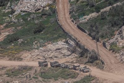
Of course, there are other confidence-building measures that would be highly significant: ending the bombardments, withdrawing Israeli troops, or prosecuting the many Israeli soldiers responsible for killing Lebanese civilians.
Unfortunately, the first two do not appear to be on the table, while the third remains, for now, closer to science fiction.
Resolving the border issue is far more within the Lebanese state’s reach than curing our southern neighbors of their addiction to violence.
If Beirut were to succeed in obtaining an official Israeli recognition of the 1949 border, it would reassure displaced residents that they will one day return to their land and demonstrate what Lebanon stands to gain from distancing itself from Iran.
Such a step would also make it easier for the Lebanese state to deal with Hezbollah, potentially opening the door to the recovery of occupied territories and, ultimately, to ending the war.
Finally, if the Lebanese state genuinely wants to pursue this path, it could avoid a repeat of the 2000 scenario — when Israel claimed it no longer possessed its original 1949 maps — by obtaining them from Professor Issam Khalife, who managed to secure copies and has sent them to the Lebanese authorities numerous times over the past decades.
Current officials would do well to request them again, along with his extensive and authoritative body of work on all of Lebanon’s borders.
Should our unfortunate Lebanese state ever emerge from its long paralysis over the South, the credit will belong to those who, like Issam Khalife, have long worked alone to prepare its return.
This article was originally published in French in L’Orient-Le Jour and was translated by Sahar Ghoussoub and Rayane Saadeh.
For a full list of sources, readers may contact the author at rayanesaadeh2026@proton.me.
 In infographics: How 4 months of Israeli attacks and war devastated Lebanon