A view of Qornet al-Sawda, one of the disputed areas in Lebanon. (Credit: Claire Srour)
")


")


A regular source of tension that sometimes degenerate into deadly armed clashes, land disputes in Lebanon have been going on for years.
The disputes typically involve plots lands that were never officially added in the registry.
During the French mandate (1920-1943), nearly 50 percent of Lebanon’s land registry was prepared by France, former MP Fares Souaid told L’Orient-Le Jour.
“After that, the Lebanese authorities registered around 20 percent of the remaining lands, but their work has not been completed with [the start] the [1975-1990] Civil War. The cadastral survey did not resume when the conflict ended, as a new balance of political power was established,” explained Souaid.
Some lots continue to follow a classification that dates back to the Ottoman Empire, which occupied Lebanon for 400 years. The disputed areas include the amiri land, which belonged to local governors at the time, as well as undivided land belonging to local authorities.
Entire villages sometimes continue to follow the Ottoman measure known as the qirat, which complicates sales, purchases and inheritance. Dr.Issam Khalifeh, a former history professor at Lebanese University, explained that, in such situations, the limits of each plot of land are passed down from father to son, and the presence of the village moukhtar is required for each transaction.
L’Orient-Le Jour sheds light on four major land disputes that often make headlines.
1. Fneideq vs Akkar al-Atiqa: Seeking al-Qammoua
 A view of the natural Qammoua site. Credit : Kassem Hamade
In North Lebanon, the two Sunni-majority neighboring villages of Fneideq and Akkar al-Atiqa, have been at loggerheads for decades. Each claims ownership of the natural Qammoua site, each with supporting documents.
Qammoua Forest, which covers 17 million square meters, is home to numerous species of trees and plants, as well as agricultural land. It is also a tourist attraction in summer. Several attempts to turn it into a nature reserve have failed.
Many victims paid the price for this conflict. At the end of June 2023, a forest ranger from Akkar al-Atiqa was found dead in obscure circumstances. In August 2021, a young man from Fneideq died in clashes in Qammoua over the illegal felling of trees in the area.
Journalist Moustapha al-Bachir, who is familiar with the case, recalled that former Prime Minister Saad Hariri tried to complete the land registry works in Qammouaa to put an end to the conflict. But the work never happened, “due to a lack of will on the part of certain residents,” he told L’Orient-Le Jour.
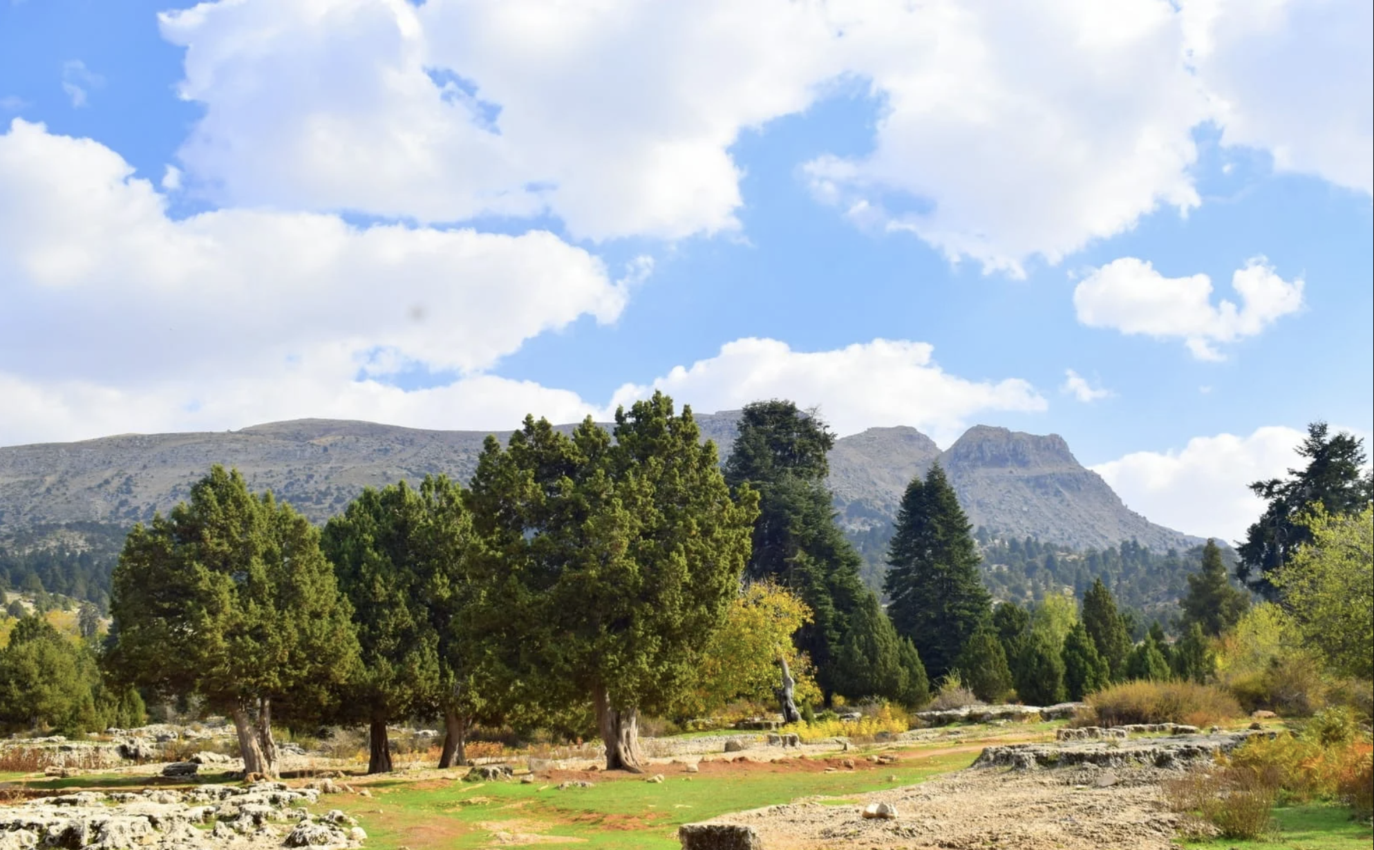
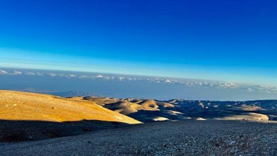
2. Bsharri vs Dinnieh: Who owns Qornet al-Sawda?
 Qornet al-Sawda, the highest summit in Lebanon. Credit : Samih Zaatar
The beautiful Qornet al-Sawda, at over 3,000 meters above sea level, is the highest summit in Lebanon. Situated between the predominately-Christian village of Bsharri and the predominately-Sunni village of Bqaa Safrin in Dinnieh, the summit is disputed by the two municipalities.
Qornet al-Sawda is an indivisible piece of land that is meant to be managed by the region’s municipalities, but the lack of a precise demarcation has repeatedly sparked conflicts over water resources.
Most recently, on July 1, two men from Bsharri were killed in an exchange of fire with the Bqaa Safrin residents and the Lebanese Army, which has a military base there.
In 2021, Bqaa Safrin’s municipality accused Bsharri residents of killing cattle in Qornet al-Sawda.
In June 2020, people hailing from Dinnieh and others from Maryata in Zgharta were shot at in the area, within a few days of each other. During the same period, unidentified people sabotaged the irrigation pipelines of farmland in Dinnieh.
3. Aqoura vs Yammouneh: The jurd of discord
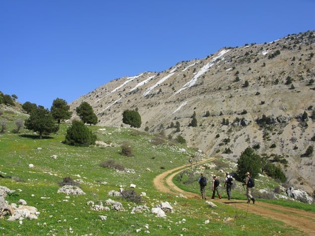 Hikers on the Afqa-Aqoura trail. Credit : Christian Akhrass
The jurd (a semi-arid mountainous region) of Aqoura — a beautiful natural site with trees and water basins — is disputed by the historically Christian village of Aqoura in Jbeil district and the historically Shiite village of Yammouneh in Baalbek. Each of the villages claims ownership of the jurd, and submitted documents in support of its claim.
In order to understand the origins of this dispute, one needs to go back to the state of Greater Lebanon, which was first declared in 1920. At that time, the limit was drawn between Mount Lebanon and the Bekaa Valley, and the disputed area of the jurd was officially granted to Aqoura in 1936 A 1967 court ruling reconfirmed Aqoura’s ownership of the jurd during a land cadastral survey in Yammouneh — a decision that has since been contested by Yammouneh residents.
According to the al-Modon news website, the first recorded incident between these two localities dates back to 1934, when 20 were killed people in a dispute over hay used to feed livestock.
Historian Alexandre Abi Younes told L’Orient-Le Jour that the Lebanese Army tried, under former President Fouad Chehab (1958-1964), to put an end to the conflict by demarcating the border between the two villages, according to the map adopted to separate the Mount Lebanon Mutasarrifate from the Damascus Eyalet under the Ottoman Empire.
This process resulted in a reconciliation between the Chreif family, which hails from Yammouneh, and Abi Younis family, which hails from Aqoura. But the agreement fizzled out.
In 2018, armed members of the Chreif family shot at two Aqoura municipal employees who were patrolling land claimed by Yammouneh. This incident prompted several officials, including Hezbollah leader Hassan Nasrallah and Maronite patriarch Beacharal- Rai, to call for calm.
4. Lasa: Shia residents face off against the Maronite Church
 View of Lassa. Credit: Bechara Maroun
Unlike the other disputes, which are mainly to amiri or undivided land, in Lasa in Jbeil district, the conflict revolves around private properties, once again taking a sectarian turn.
The village of Lasa, with its predominantly Shiite population and Christian minority, is regularly a scene of disputes over illegal construction projects. These disputes have long pitted the Archdiocese of Jounieh, which owns lands in Lasa, against the area’s Shiite inhabitants.
The Archdiocese claims ownership of over 3 million square meters of land in Lasa, acquired in the 1930s. The boundary maps for these properties date back to 1939. By the early 2000s, more than 1 million meters had been the subject of an extensive official cadastral survey, and title deeds had been issued to the archdiocese for a large number of plots.
However, more than 70 complaints have since been lodged by the archdiocese for encroachments on private property, including the illegal construction of houses. At times, some of the disputes involved members of Hezbollah living in Lasa.
Souaid told L’Orient-Le Jour that the dispute in Lasa “was not initially a sectarian problem, but an administrative problem that has taken on the appearance of a sectarian problem.”
“The Shiites believe that the land registers drawn up under the French mandate established the hegemony of the Christians,” he continued. “They believe that the political corruption of the mandate gave land to those who didn’t deserve it.”
This article was originally published in French in L'Orient-Le Jour. Translation by Joelle El Khoury.
 US strikes hit around Iran's Qeshm island: Iranian media